 Jan Holinka


Create your own LandXML files for machine control directly in Blender.
LandXML Import Export is a Blender add-on designed for geodetic, terrain, and construction workflows where real-world coordinates matter.
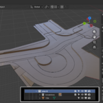
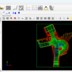
Instead of relying on expensive CAD software just to prepare machine control data, you can build your terrain model in Blender and export it to LandXML for downstream use in GPS-guided earthworks and construction workflows.
The add-on is especially useful for creating and preparing TIN-based terrain models with breaklines — the kind of data commonly used in machine control systems.
Real project usage timelapse(short version): https://youtu.be/QsBUcahLWrc
Full workflow: https://youtu.be/GSzPQPkLkwM
What this add-on does
Import from LandXML into Blender:
-
TIN surfaces
-
Breaklines
-
Contours
-
Boundaries
-
CgPoints
-
PlanFeatures
Export to LandXML:
-
TIN surfaces
-
Breaklines
This makes it possible to inspect existing LandXML data and, more importantly, create your own LandXML models directly from Blender geometry.
Export workflow
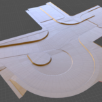
TIN surfaces are generated directly from mesh faces and automatically triangulated during export. Breaklines are exported from separate edge-only mesh objects, where each object must form a single connected non-branching polyline. Both TIN surfaces and breaklines are gathered from the active collection during export. Invalid breakline objects are skipped and reported automatically.
Built for real-world coordinates
LandXML Import Export is not just a simple geometry converter.
It gives you control over:
-
real-world coordinate reference of the Blender origin
-
axis orientation
-
XY order used in the LandXML file
-
origin calculation from a known survey point
-
centered import with preserved coordinate reference
This is essential when working with survey data, terrain models, and machine control workflows where correct positioning is critical.
Units support (Metric & Imperial)
- LandXML units are automatically detected on import
- Geometry is internally converted to Blender meters (1 BU = 1 m)
- Reference values remain in the original survey units (e.g. feet)
-
Export writes correct
based on current settings
This ensures consistent behavior across different coordinate systems and software.
Why use Blender for this?
Machine control is becoming more and more common, while many traditional CAD tools remain unnecessarily expensive for smaller teams, independent professionals, or custom one-off projects.
This add-on makes Blender a practical tool for preparing LandXML-based terrain data in a flexible and affordable way.
Export validation
During export, the add-on checks breakline validity and reports invalid branching objects to help prevent broken LandXML output.
Interface location
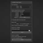
3D Viewport → N Panel → Survey → LandXML Import Export
Ideal for
-
terrain modeling
-
geodetic workflows
-
construction preparation
-
excavation planning
-
machine control model creation
-
LandXML inspection and conversion