LandXML Import Export – Geodetic & Construction Workflow
 Jan Holinka


LandXML Import Export
Import and export LandXML survey data with support for real-world coordinates, axis orientation, Blender origin reference, Z rotation, and file XY order.
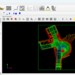
Designed for geodetic, terrain, and construction workflows, especially where Blender is used to create or inspect LandXML data for downstream machine control use.
Panel location:
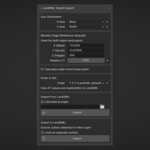
3D Viewport → N Panel → Survey → LandXML Import Export
Installation
Open Blender (
5.0+).Go to
Edit -> Preferences -> Get Extensions -> arrow in the upper right corner → Install from Disk.Select the ZIP file and click
Install from Disk.
Main Features
Import from LandXML:
TIN surfaces
Breaklines
Contours
Boundaries
CgPoints
PlanFeatures
Export to LandXML:
TIN surfaces
Breaklines
The add-on applies axis orientation, Blender origin reference, Z rotation, and file XY order consistently on both import and export.
Axis Orientation
X Axis / Y Axis can be set to East, West, North, or South
One axis must be East/West and the other North/South
Used for coordinate conversion during both import and export
Blender Origin Reference
X (East), Y (North), Z (Height) define the real-world coordinates of Blender world origin
Rotation is applied around Z
The same reference is used for both import and export
Units (Metric & Imperial)
The add-on supports both metric and imperial LandXML files.
-
Linear units are automatically detected from the LandXML
tag on import - Geometry is internally converted to Blender meters (1 BU = 1 meter)
- Blender Origin Reference and known point coordinates are always interpreted in the current LandXML unit (e.g. feet for imperial files)
-
On export, the add-on writes the
block according to the currently selected unit
This ensures consistent coordinate transformations and allows working seamlessly with both metric and imperial survey data.
Calculate Origin from Known Point
The add-on can calculate the Blender origin reference from a known point already present in the scene.
Typical workflow:
set axis orientation and rotation
enter known coordinates
select the corresponding point in the scene
calculate origin
apply the calculated reference values
Order in File
Choose whether LandXML uses:
Y X Z - this should be LandXML default
X Y Z
This affects only the order of horizontal values in the file, not the axis mapping itself.
Import
The importer:
reads the LandXML file
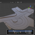
creates a new collection under the active collection
creates subcollections only for element types that exist in the file
Supported import data:
TIN Surfaces
Breaklines
Contours
Boundaries
CgPoints
PlanFeatures
Optional Calculate at Origin can center imported geometry at Blender origin while preserving coordinate reference.
Export
Export uses the active collection as the source, including nested subcollections.
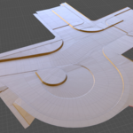
Meshes with faces are exported as TIN surfaces
Edge-only meshes are exported as breaklines
Vertex-only meshes are exported as CgPoints
TIN surfaces are generated directly from mesh faces and automatically triangulated during export.
Breaklines are exported from separate edge-only mesh objects, where each object must form a single connected non-branching polyline.
Both TIN surfaces and breaklines are gathered from the active collection during export.
Invalid breakline objects are skipped and reported automatically.
Notes
Breaklines can also be exported as a separate surface named
"lines"Export preview shows collection name, object counts, and breakline validity
The add-on requires Blender
5.0.0+Blender precision decreases as coordinate values get farther from the origin. To maintain millimeter precision (0.001), you should remain within coordinates smaller than 999. For centimeter precision (0.01), it should remain within coordinates smaller than 9999, and so on.
For larger projects, the scene can be split into multiple files. Support for multiple reference origins separated by collections may be added in the future or on demand, allowing much larger projects to preserve 1 mm precision while still being exported into a single file.
Discover more products like this
Import-Export terrain geodetic survey tin engineering breaklines landxml coordinates construction machine-control