Survey Points Exporter – Geodetic & Construction Workflow
 Jan Holinka


📘 Documentation
Survey Points Exporter – Blender Add-on
1. Introduction
Points Export is a professional Blender add-on for exporting point coordinates from 3D scenes into survey-friendly formats.
It supports:
-
vertices and empty objects
-
user-defined coordinate systems
-
configurable axis orientation and rotation
-
TXT and CSV export formats
The add-on is designed for surveying, civil engineering, road design, and GIS workflows.
2. Installation
-
Download the add-on ZIP file
-
Open Blender
-
Go to
Edit → Preferences → Get Extensions→ arrow in the upper right corner → Install from Disk -
Select the ZIP file and Click Install from Disk
-
Open the N-panel in the 3D Viewport (
N) -
Find the Survey tab
3. Export Types
3.1 Mesh Object
Exports vertices from the active mesh object.
Options:
-
Export only selected vertices
-
Ignore hidden vertices
3.2 Collection (mesh objects and empties)
Exports:
-
vertices from all mesh objects
-
locations from empty objects
within the selected collection.
3.3 Collection (empties only)
Exports only empty object locations from a collection.
4. Coordinate System Configuration
4.1 Axis Orientation
-
X and Y axes can be set to North, South, East, or West
-
X and Y must be perpendicular
-
Z-axis rotation can be applied if required
This allows alignment with real-world survey coordinate systems.
4.2 Reference Point
Reference points are used to align Blender coordinates with real-world coordinates.
Calculate Reference from Known Point
-
Select a vertex or empty with known real coordinates
-
Enter known X, Y, Z values
-
Click Calculate Reference
-
Click Apply Calculated Reference
4.3 Verification
Use Get Active Vert / Empty Coords to:
-
display transformed coordinates
-
verify correctness against known values
5. Export Settings
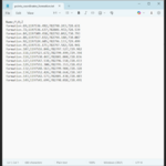
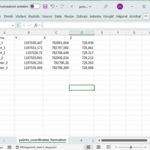
5.1 Point Naming
-
Custom prefix
-
Optional object name inclusion
Example:
5.2 Precision
-
Decimal places: 0–10
5.3 File Formats
TXT
-
Configurable delimiter
-
Configurable decimal separator
CSV
-
Configurable delimiter
-
Configurable decimal separator
Supported delimiters:
-
comma
-
semicolon
-
tab
6. Coordinate Editing (Inverse Transformation)
The add-on allows setting empty/vert positions using real-world coordinates.
Set Active Vert / Empty to Coordinates
-
Enable the tool
-
Enter target X, Y, Z
-
Select a vertex or empty
-
Click Set to Coordinates
The inverse transformation is applied automatically.
7. Visual Tools
7.1 Compass Overlay
A compass is displayed in the 3D viewport showing:
-
current X and Y axis orientation
-
coordinate system alignment
8. Settings Management
8.1 Save Settings
Opens a file dialog and saves the current add-on configuration to an external
.txt file.
The saved settings include:
-
export options
-
axis orientation
-
reference point
-
formatting settings
The settings file can be reused across different Blender projects
and shared between computers or users.
8.2 Load Settings
Opens a file dialog and loads add-on settings from a previously saved
settings .txt file.
All stored parameters are applied immediately after loading.
8.3 Import from Survey Points Importer
If the compatible add-on is installed (currently in development), the following can be imported:
-
axis orientation
-
reference point coordinates
9. Supported Coordinate System Examples
S-JTSK
-
X Axis: South
-
Y Axis: West
-
Z Rotation: 0°
10. Requirements
-
Blender: 4.2.0 or later
11. License
GNU General Public License v3.0 or later
(GPL-3.0-or-later)
❓ FAQ
What is the reference point used for?
The reference point is used only during coordinate calculations within the add-on.
It does not modify Blender objects or scene coordinates.
During export and coordinate queries, point positions are transformed
using the configured reference point so that the output matches
the defined real-world survey coordinate system.
Blender precision decreases as coordinate values get farther from the origin. To maintain millimeter precision (0.001), you should remain within coordinates smaller than 999. For centimeter precision (0.01), it should remain within coordinates smaller than 9999, and so on.
For larger projects, the scene can be split into multiple files. Support for multiple reference origins separated by collections may be added in the future or on demand, allowing much larger projects to preserve 1 mm precision while still being exported into a single file.
Why must X and Y axes be perpendicular?
Non-perpendicular axes would result in invalid coordinate transformations. The add-on enforces correct orientation.
Why do my exported coordinates not match expected values?
Check:
-
axis orientation
-
reference point calculation
-
Z-axis rotation
-
decimal separator and delimiter settings
Can I move objects using real-world coordinates?
Yes. Use Set active vert/empty to manual coordinates to position verts/empties via inverse transformation.
Where are settings stored?
Settings are saved as a Blender text block:
Is the add-on compatible with other survey tools?
Yes. TXT and CSV outputs are compatible with most:
-
CAD software
-
GIS tools
-
survey and machine control workflows
How do I get support or report a bug?
Contact:
📧 [email protected]
Have questions about this product?
Login to message
| Blender Extension Compatible | Yes |
| Published | 8 months ago |
| Blender Version | 4.2 - 5.0 |
| Extension Type | Add-on |
| License | GPL |
Discover more products like this
coordinates reference-point construction survey axis-orientation Export Import-Export engineering Workflow csv precision points