Survey Points Importer – Geodetic & Construction Workflow
 Jan Holinka


What is a reference point?
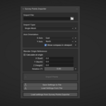
A reference point is an offset applied to all coordinates. It's used to shift large coordinates (like UTM) to smaller values suitable for Blender. Blender uses single-precision floating-point (float32) for vertex positions, which provides approximately 7 decimal digits of precision. Coordinates with more than 6-7 significant digits will start losing precision due to floating-point rounding. This precision limitation is normal in 3D engines and is optimized for GPU performance. CAD software typically uses double-precision (float64) or other techniques to maintain precise coordinates for very large numbers.
When should I use "Calculate at origin"?
Use it when you want the imported points centered at Blender's origin (0,0,0), especially with large coordinates. The add-on automatically detects when coordinate values may cause precision loss beyond three decimal places. For values greater than 9999, a warning is displayed recommending the use of the “Calculate origin at center of geometry” checkbox.
What does Z Rotation do?
It rotates the imported points around the vertical (Z) axis. This feature is primarily intended for rotating points according to the orientation of drawing documentation, which are often at an angle.
Important: Using Z Rotation can be confusing and may lead to incorrect coordinate placement.
We strongly recommend:
- Rotate reference images instead: If possible, rotate the reference images of project documentation in Blender rather than rotating the point coordinates
- Increased verification of coordinate correctness when using Z Rotation
- Only use Z Rotation if necessary
- Consider using Axis Orientation mapping instead, which is more intuitive and less error-prone
Which import mode is fastest?
Single mesh mode is the fastest and most memory-efficient.
Can I cancel an import?
No, once started, the import runs to completion. For very large files and Empty Objects import type, be patient.
Can I apply multiple transformations?
Yes, transformations are applied in order: Reference Point → Z Rotation → Axis Orientation.
How do I know what Axis Direction settings to use?
Check your survey data documentation. Most systems use X=East, Y=North (default), but some use different conventions. Be aware that in geodesy, an axis oriented toward a given cardinal direction means that coordinate values increase in absolute magnitude in that direction (including negative values).
What's the difference between the import modes?
- Single mesh: All points in one object (fastest, most efficient)
- Grouped meshes: Separate objects per unique alphabetic prefix in Point Name (organized by naming convention)
- Empty objects: Individual empty objects per point (best for reference points), slow for large datasets.
Can I import files without Z coordinates?
Yes, you can import files with only X and Y coordinates. Z will default to 0.
Where are saved settings stored?
Settings are stored as a Blender text datablock (`.SurveyPointsImportSettings`) in your .blend file.
What if my file has extra columns?
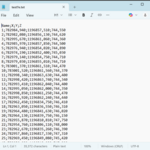
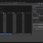
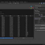
Extra columns are ignored. Only recognized columns (X, Y, Z, Point Name) are used. You can specify columns directly in dialog after clicking Import Points.
Do I need to specify the delimiter?
No, the add-on automatically detects semicolon, comma, tab, or space delimiters.
Will importing replace existing objects?
No, each import creates new objects. Existing objects are not affected.
Can I import multiple files at once?
No, import one file at a time.
How many points can I import?
The add-on efficiently handles large datasets. 10,000+ points typically import in seconds (depending on your hardware and Import Type).
Does the file need a header row?
No, but it's recommended for clarity. The add-on detects whether the first row is a header or data.
Can I use comma as a decimal separator?
Yes, both dot (.) and comma (,) are supported as decimal separators. If you are using comma as decimal separator, you have to use something else (like semicolon) as delimiter.
What versions of Blender are supported?
Blender 5.0.0 and later. It may work on older versions, but this has not been tested
Have questions about this product?
Login to message
| Blender Extension Compatible | Yes |
| Published | 9 months ago |
| Blender Version | 5.0 |
| Extension Type | Add-on |
| Render Engine Used | Blender-Internal |
| License | GPL |
Discover more products like this
survey import construction csv coordinates blender addon BIM points cad geodesy engineering