 Jan Holinka


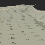
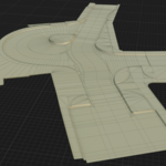
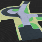
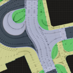
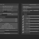
Survey Terrain Tools is a terrain-focused Blender add-on designed for fast, precise, and practical mesh workflows used in survey, civil engineering, and CAD-style modeling.
It provides a compact set of deterministic tools for slope-based editing, offset construction, geometry analysis, and world-space measurement — all directly inside Blender.
This add-on is built for production use, where accuracy, control, and predictable results matter more than artistic workflows.
What Survey Terrain Tools helps you do
- edit terrain geometry with exact slope control
- create offset lines and perpendicular extrusions with consistent width behavior
- align hidden vertices to a computed or reference plane in Z
- construct geometry interactively using cursor-driven tools
- slide vertices along edges with precise world-space distance
- generate circle sectors in true 3D or plan view (XY)
- measure length, area, volume, and angles directly in Blender
- annotate slopes with labels and drop-direction arrows
- generate intersection edges between face planes
Key Features
Slope editing and terrain shaping
Set slope between vertices, apply slope along a line, or build offset geometry using perpendicular extrusion tools.
Supports:
- single slope edits
- batch slope application on lines
- perpendicular extrusion with slope control
- slope ranges along a line
These tools are ideal for terrain shaping, embankments, ditches, and road modeling.
Perpendicular extrusion with corner correction
Extrude vertices along angle bisectors of connected edges to create offset geometry.
With Angle Correct Length, corner behavior is compensated so offset width stays more consistent through bends.
Supports:
- open lines and closed loops
- optional face fill
- slope-controlled extrusion
Align Hidden Verts to Plane (Z)
Align hidden vertices based on visible reference vertices.
Supports:
- 2-point rule (vertical plane logic in XY)
- 3-point projection to a full plane
Useful for workflows where geometry is first edited in plan view and final elevation is resolved afterward.
Face intersection edges
Generate intersection edges between selected face planes.
- works on two or more faces
- creates edges without deleting faces
- useful for technical construction and geometry analysis
Cursor-driven edge creation & vertex sliding
Create geometry interactively and precisely.
- draw edges toward cursor with optional fixed length
- slide vertices along connected edges using exact world-space distance
- optional planar (XY) mode for plan-view workflows
Circle sector construction
Create arcs and circular geometry using:
- 2 points + radius
- 3 points (true 3D circle)
Supports:
- 3D tilted arcs
- planar (XY) arcs
- adjustable tessellation
World-space measurement tools
Measure geometry directly in Blender:
- edge length (3D and planar XY)
- face area (3D and projected XY)
- volume of selected solid
- angle between two edges (3D or planar XY)
Results are shown instantly in the UI and are ideal for quick iterative checks.
Survey-style slope annotations
Automatically generate:
- slope labels
- drop-direction arrows
Supports:
- Percent (%)
- Ratio (1:x)
Annotations are placed at edge midpoints and organized in a separate collection.
Designed for practical technical workflows
Survey Terrain Tools is especially useful for:
- civil engineering modeling
- terrain shaping and grading
- road and infrastructure geometry
- survey-based mesh editing
- CAD-like construction workflows inside Blender
- world-scale terrain adjustments
UI location
3D Viewport → N Panel → Survey → Survey Terrain Tools
Requirements
- Blender 5.0+
- No external Python dependencies
Why use this add-on
Blender is powerful, but many terrain and technical workflows still require too many manual steps.
Survey Terrain Tools introduces a focused set of operators that make slope editing, offset construction, and measurement workflows significantly faster, more consistent, and more predictable.