Imagegis2Camera
 jangstudio


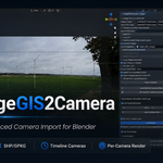
ImageGIS2Camera Documentation
User guide for ImageGIS2Camera v1.0.46 - Blender camera import, GIS positioning, EXIF data and per-camera rendering
Overview
ImageGIS2Camera imports camera viewpoints into Blender from geotagged image folders or GIS point files. It is designed for photomontage preparation, visual-impact studies, renewable-energy visualisations, GIS-to-3D workflows and projects where many viewpoints must stay organised, named and renderable.
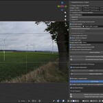
The add-on creates one Blender camera per source photo or vector point, places all imported cameras inside a dedicated ImageGIS2Camera collection, attaches background photographs, reads EXIF lens and heading metadata where available, stores custom render resolution on each camera and builds a frame-by-frame camera sequence on the Blender timeline.
|
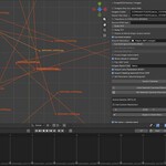
Core idea: the timeline becomes a camera selector After import, each camera is assigned to a consecutive Blender timeline frame using camera markers. When you move the timeline, the active camera changes automatically. This works like a keyframed viewpoint sequence for rendering, while technically using Blender camera markers rather than transform keyframes. |
Installation
1. Open Blender 4.0 or newer.
2. Go to Edit > Preferences > Add-ons.
3. Click Install... and select the ImageGIS2Camera ZIP file.
4. Enable the add-on by ticking the checkbox next to ImageGIS2Camera.
5. Open the 3D View, press N to show the Sidebar, then open the ImageGIS2Camera tab.
The primary controls appear in 3D View >
Sidebar > ImageGIS2Camera. Additional rendering controls for
custom camera resolution are also available in the Output Properties
panel.
ImageGIS2BLEND Python source code is licensed under GNU GPL v3.0 or later, in accordance with Blender add-on licensing requirements.
Documentation, logo, product name, screenshots, marketing materials, demo assets, tutorial files, example scenes, presets, product descriptions and other non-code materials are not licensed under the GPL unless explicitly stated otherwise.
Unauthorized copying of non-code materials, false authorship claims, removal of copyright notices, misleading forks, misuse of the ImageGIS2BLEND name or branding, and non-compliant redistribution may result in takedown requests and legal enforcement.
Have questions about this product?
Login to message
| Blender Extension Compatible | Yes |
| Dev Fund Contributor | |
| Published | 4 months ago |
| Blender Version | 4.5 |
| Extension Type | Add-on |
| Render Engine Used | Cycles, Eevee, Freestyle, Luxrender, Mental-Ray, Octane, Vray, Yafaray |
| License | GPL |
Discover more products like this
GIS georeferenced images Batch rendering EXIF GPS Blender GIS panoramic camera blender addon camera matching photomontage Visualization camera import shapefile