Survey Image Aligner – Geodetic & Construction Workflow
 Jan Holinka


Documentation
Overview
Survey Image Aligner is a Blender add-on for accurately aligning reference or survey images to real-world coordinates.
It is designed for technical workflows where precision matters, such as surveying, civil engineering, infrastructure modeling, and site visualization.
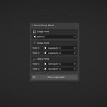
The add-on aligns an image plane using two corresponding point pairs:
-
two points defined on the image
-
two points defined in 3D space (world coordinates)
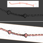
Based on these correspondences, the add-on calculates the exact rotation, scale, and translation required to align the image to the world XY plane.
How It Works
To perform an alignment, the following data is required:
-
Two reference points on the image
These points represent known locations visible in the image. -
Two reference points in 3D space
These points define the real-world positions (XY coordinates) the image should align to.
Using these two point pairs, the add-on computes a transformation that matches the image to the defined real-world positions.
Typical Workflow
-
Add or select an Image Plane in the Blender scene.
-
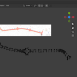
Define two points on the image corresponding to known locations.
-
Define two points in 3D space representing their real-world positions.
-
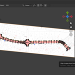
Run the alignment operation.
-
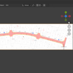
The image plane is transformed to match the defined world coordinates.
The resulting image can then be used as a precise modeling reference.
Key Features
-
Two-point correspondence alignment (image ↔ world space)
-
Accurate rotation, scale, and translation
-
Alignment to world XY plane
-
Works with existing image planes
-
Clean and minimal user interface
Requirements
-
Blender 5.0 or newer
-
An image plane to align
-
Two known reference points on the image
-
Two corresponding reference points in 3D space
Limitations
-
Alignment is limited to the XY plane
Intended Use
This add-on is intended for users who work with measured data and need their reference images to match real-world scale and orientation before modeling.
It is not a GIS or photogrammetry tool, but a lightweight and reliable alignment utility for Blender-based technical workflows.
Have questions about this product?
Login to message
| Blender Extension Compatible | Yes |
| Published | 8 months ago |
| Blender Version | 5.0 |
| Extension Type | Add-on |
| License | GPL |
Discover more products like this
coordinates technical image plane real-world-scale precision survey site layout reference image Workflow blender addon alignment Civil Engineering