Urban Tools
 ParametrStudio




// DOCUMENTATION
Urban Tools
Visualize and analyze OpenStreetMap data — directly in Blender. The workflow runs in five phases: download, tag extraction, geometry generation, analysis, and material export.
Blender 4.2 LTS – 5.1
OSM / Overpass
v1.0.5
Save your .blend file before you start. All working data (osm_download.osm, osm_tags.json) is stored next to your .blend file. The add-on will remind you if you forget.
// INSTALLATION
1 Open Blender and go to Edit > Preferences > Add-ons
2 Click Install, select the downloaded .zip file, and enable the add-on
3 Press N in the 3D Viewport to open the sidebar — look for the Urban tab
4 Type in your desired location and hit Enter — done
2 Click Install, select the downloaded .zip file, and enable the add-on
3 Press N in the 3D Viewport to open the sidebar — look for the Urban tab
4 Type in your desired location and hit Enter — done
// WORKFLOW
Phase 0 — Download with Location
Save your .blend file first. Enter an address in the Location field and use Expand Radius to widen the download area (recommended: 200–300 m). Click Find Location to fill in latitude and longitude automatically, then Download OSM to save osm_download.osm next to your .blend file.
Tip: ideal .osm file sizes are 1–2 MB. Check the file size before generating geometry.
Phase 1 — Extract Tags
Click Extract Tags to process the OSM file into osm_tags.json. Repeat this step whenever the OSM file is updated or replaced.
Phase 2 — Generate Geometry
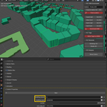
Building 3D generates buildings with height and function tags where available; additional info is stored under Object Properties > Custom Properties. Road 2D generates 2D street and road outlines.
Phase 3 — Visualization / Analysis
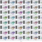
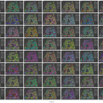
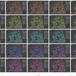
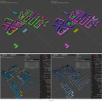
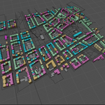
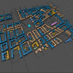
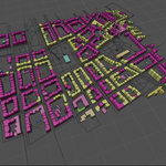
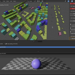
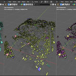
Function assigns each building use type a unique color; shuffle combinations with Seed. Height – Random colors each unique building height, randomized but repeatable via Seed. Height – Gradient maps height to a single-hue gradient, adjustable via Hue. Click Show Colours to switch the viewport to Object Color mode for fast, editable previews.
Phase 4 — Export / Material Generation
Click Assign Materials to convert viewport colors into real materials. Each object gets a material matching its Object Color, compatible with both Cycles and Eevee. Materials are reused by color, never duplicated.
// VERSION HISTORY
v1.0.7 2026-07-28 · current
Automatic Overpass server fallback. When the main OSM server is overloaded or blocks the request (errors 406, 429, 504), the add-on retries and switches to a European backup server on its own. You can also pick the server manually in the panel. Longer timeouts for slow responses.
v1.0.5 2026-07-18
Compatibility & stability update — one version for Blender 4.2 LTS – 5.1.
• Fixed the „osm_download.osm not found“ error and downloads that silently did nothing. The cause: with an unsaved .blend, the add-on saved data to one folder and looked for it in another. All data now lives next to your .blend file — just save it before you start; the add-on will remind you if you forget.
• Clear messages instead of Python tracebacks — if you skip a step, it tells you exactly what to run first (e.g. „run 'Download OSM' first“).
• Rewritten networking for reliable downloads across all supported Blender versions; respects the „Allow Online Access“ preference.
• Existing project files from 1.0.4 keep working — no re-download needed.
• Fixed the „osm_download.osm not found“ error and downloads that silently did nothing. The cause: with an unsaved .blend, the add-on saved data to one folder and looked for it in another. All data now lives next to your .blend file — just save it before you start; the add-on will remind you if you forget.
• Clear messages instead of Python tracebacks — if you skip a step, it tells you exactly what to run first (e.g. „run 'Download OSM' first“).
• Rewritten networking for reliable downloads across all supported Blender versions; respects the „Allow Online Access“ preference.
• Existing project files from 1.0.4 keep working — no re-download needed.
v1.0.4
2025-11-29
A fundamental geometry-generation change — from minutes to seconds.
• Buildings are no longer extruded one by one via edit-mode operators (which forced a full scene update per building) — geometry is now built directly in memory with BMesh and written to the mesh in a single step.
• Buildings are no longer extruded one by one via edit-mode operators (which forced a full scene update per building) — geometry is now built directly in memory with BMesh and written to the mesh in a single step.
Urban Tools is designed to be fast, simple, and tailored for urban design, architecture, and GIS workflows in Blender.
This add-on uses data from OpenStreetMap, © OpenStreetMap contributors. Data retrieved via Overpass API.
This add-on uses data from OpenStreetMap, © OpenStreetMap contributors. Data retrieved via Overpass API.
Discover more products like this
Object Color Architecture Tools blender addon data-visualization Map Data OpenStreetMap OSM Import GIS Urban Planning City Modeling Building Color procedural