Urban Tools
 ParametrStudio




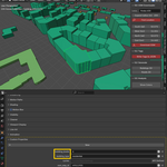
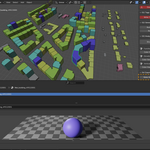

I get eror after "Generate Building" command, why?
Blender requires a saved scene to be stored on your hard drive. Please save the file before running the Generate Building command.
How accurate is the positioning of OSM data in Blender?
UrbanOSM uses a simplified geographic projection based on the Web Mercator approach. This means coordinates are converted approximately – typically accurate to within a few meters in most urban areas. While not suitable for engineering or construction purposes, this level of precision is more than sufficient for urban studies, concept design, and visual analysis. If exact GIS-grade accuracy is required, external tools like QGIS with proper projections should be used.
Why do some buildings have incorrect or missing heights?
This addon relies entirely on the data available in the OSM file. If height information is missing, estimated, or incorrect in the original dataset, it will reflect that in Blender. The addon doesn't generate or guess data – it only visualizes what is present in the OSM source.
Is OSM data complete and consistent everywhere?
No. The availability and accuracy of OSM data depends on the location. Densely mapped cities often have detailed information like building height, function, and road types. In rural or less-mapped areas, some of this data may be missing or outdated.
What are OSM data and who creates them?
OpenStreetMap (OSM) is a collaborative, open-source mapping project. The data is created and maintained by volunteers around the world – anyone can contribute by adding or editing roads, buildings, land use, and other geographic features. It’s like Wikipedia, but for maps.
Discover more products like this
Urban Planning data-visualization Map Data Architecture Tools OpenStreetMap GIS Building Color blender addon OSM Import procedural Object Color City Modeling